 TETSXPREME:
@AZ
 AZ:
AZ:
so it's a map of a continent
AZ:
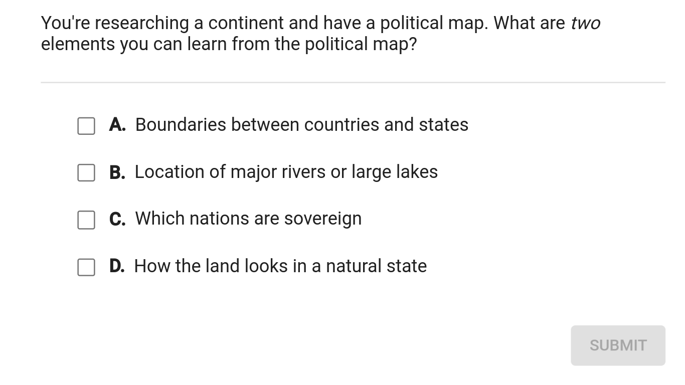
what can you tell if you look at a map
 snowflake0531:
Which ones have you eliminated
TETSXPREME:
wait i needa post something else rq o;
snowflake0531:
From morning to night, I'm still wondering why these are in mathematics-_-
AZ:
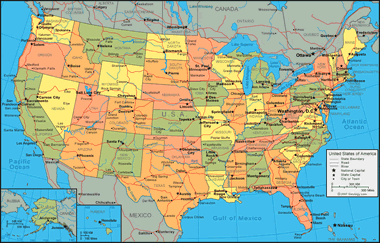
read the first paragraph when you click the link ;o and here's an example of a political map
 TETSXPREME:
i dont get it ._.
AZ:
read `"Political maps" are among the most widely used reference maps. They are mounted on the walls of classrooms throughout the world. They show the geographic boundaries between governmental units such as countries, states, and counties. They show roads, cities and major water features such as oceans, rivers and lakes.`
snowflake0531:
When you look at that map ^^^ what things do you see in the 4
TETSXPREME:
the map is to small to read anything on it o;
snowflake0531:
-_-
AZ:
okay but read the paragraph I posted from that website it shows countries, states, and counties it shows roads, cities, and major water features...
TETSXPREME:
Political Maps show boundaries between countries, states, counties, and other political units. The most commonly used political map in the United States is a map like the one above that illustrates the 50 states. Many people find this type of map by going to a search engine and making a query for "us map" or "united states map". Geology.com has some of the most frequently viewed political maps of the United States and world countries on the internet.?
AZ:
mhmmm
snowflake0531:
-_- Just look through your choices
 AZ:
AZ:
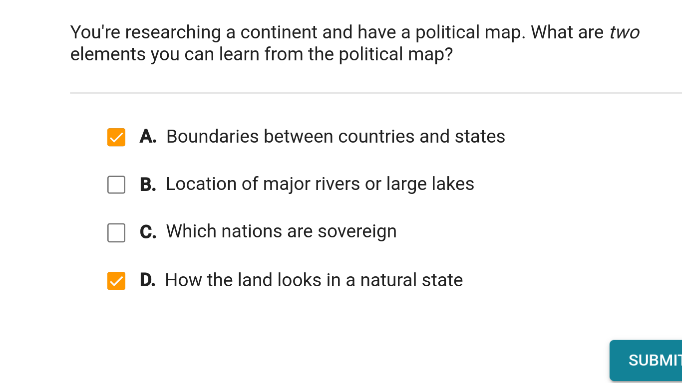
mhmmm it doesn't let you see the natural state of the land
snowflake0531:
No
AZ:
how would a map show the natural state of the land? :b but what can a map show you? look at the other choices
TETSXPREME:
B?
AZ:
there you go!
TETSXPREME:
ty C:
AZ:
yw c:
Join our real-time social learning platform and learn together with your friends!
 Twaylor:
Time flies doesn't it? I tried to not be the second squeaky wheel of the household and ended up hurting myself and others severely.
Twaylor:
Time flies doesn't it? I tried to not be the second squeaky wheel of the household and ended up hurting myself and others severely.
 clllaaaaaire:
any tips? the quality isn't the best because I am using this site on my computer
clllaaaaaire:
any tips? the quality isn't the best because I am using this site on my computer
 Midnight97:
Kinda a roleplay story between me and my friend enjoy... Part one Forgive me for all the screenshots.
Midnight97:
Kinda a roleplay story between me and my friend enjoy... Part one Forgive me for all the screenshots.
 StevenisGhost:
what type of song should I make next, and will y'all go check out my new song on
Midnight97:
My drawing sure changed over the years look at these two pictures from 2024 to no
StevenisGhost:
what type of song should I make next, and will y'all go check out my new song on
Midnight97:
My drawing sure changed over the years look at these two pictures from 2024 to no
 EdwinJsHispanic:
"poem" love is So Beautiful to have. But it's so hard to have. At this point I don't know whether its worth the wait Or if it's just millions of miles to re
EdwinJsHispanic:
"poem" love is So Beautiful to have. But it's so hard to have. At this point I don't know whether its worth the wait Or if it's just millions of miles to re
EdwinJsHispanic:
"poem" love is So Beautiful to have. But it's so hard to have. At this point I don't know whether its worth the wait Or if it's just millions of miles to re
EdwinJsHispanic:
"poem" love is So Beautiful to have. But it's so hard to have. At this point I don't know whether its worth the wait Or if it's just millions of miles to re
 Breathless:
I don't know if this would be considered art, but its close enough I believe, Any
Breathless:
I don't know if this would be considered art, but its close enough I believe, Any